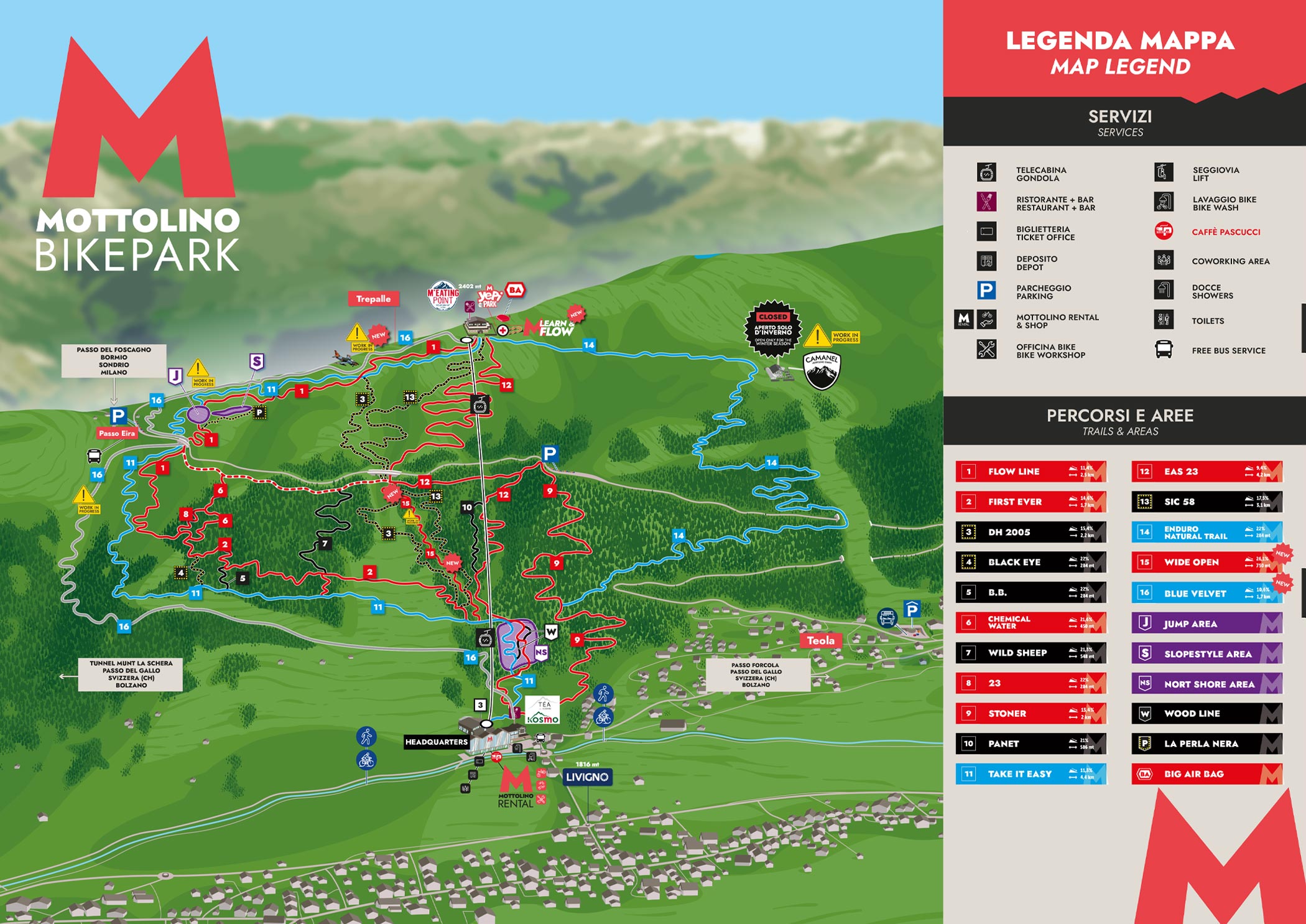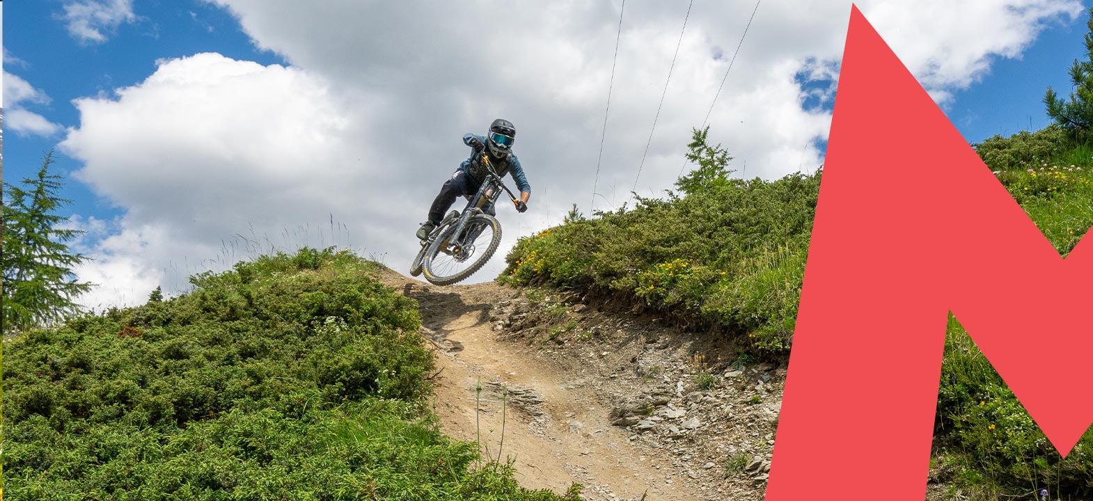
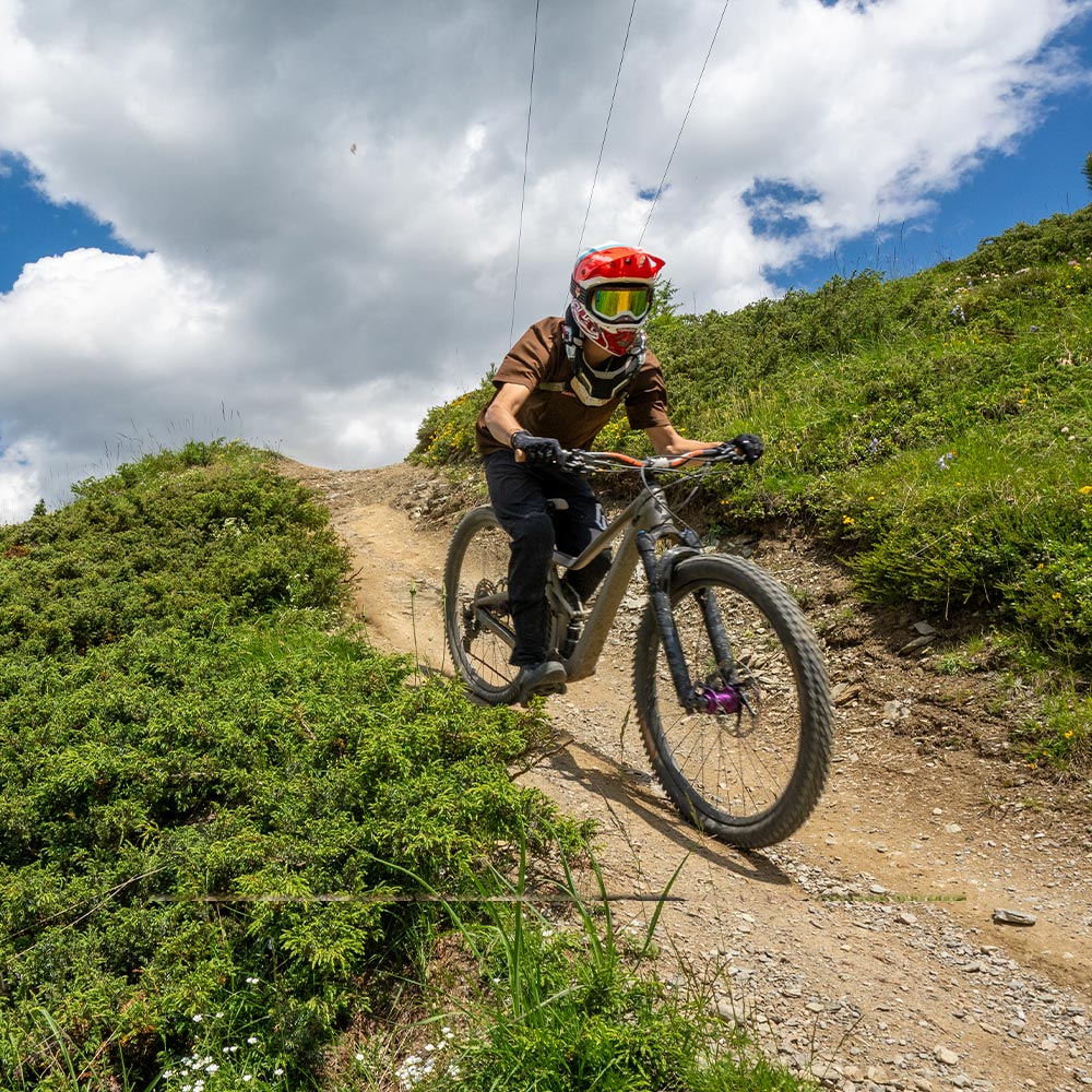
ALL THE PATHS OF MOTTOLINO BIKE PARK
Flow Trails are fast and flowing paths. The Tech Trails are more technical trails with more natural obstacles.
| | |
11 • TAKE IT EASY | |
14 • ENDURO NATURAL TRAIL | |
| 1 • FLOW LINE TRAIL: BLUE/RED - FLOW Lenght: 2.500 m - Slope: 11,4% Fast and streamlined track with tall parabolic, jumps of different measures. | |
| 12 • EAS23 TRAIL: BLUE/RED - FLOW Lenght: 4.200 m - Slope: 9,4% Built in 2014, it is a very streamlined path, fast for the more expert and secure for the beginners thanks to the average slope of 6%. The track is currently as long as 4.300 meters and starting from the Mottolino gondola. The track is currently about 4,300 meters long and, starting from the arrival of the Mottolino gondola, it winds under the same system reaching the flyover of the central runway of Mottolino, from that point, through a connection you can continue until you reach the north shore area in the final part of the bike park. | |
| 2 • FIRST EVER TRAIL: RED - FLOW Lenght: 1.700 m - Slope: 14,6% Single fast trail, but not too technical, despite some root and some steeper transitions. | |
| 9 • STONER TRAIL: RED - FLOW Lenght: 2.000 m - Slope: 13,4% Faster path in the middle of the woods with various ups and downs, ideal to gain confidence with speed. | |
| 6 • CHEMICAL WATER TRAIL: BLUE/RED - TECH Lenght: 450 m - Slope: 21,6% Path rather flat, but made fun by the presence of roots and many curves. In the final part it connects with the First Ever. | |
| 8 • 23 TRAIL: RED - TECH Lenght: 284 m - Slope: 22% The creators of the more technical « Panet » propose a more simple path but with some narrow transitions. | |
| 10 • PANET TRAIL: RED/BLACK - FLOW Lenght: 586 m - Slope: 21% A surprising red/black path in the woods, bushes, medium difficult transitions and challenging inclinations. From downhill lovers for downhill lovers. | |
| 13 • SIC58 TRAIL: BLACK - FLOW Lenght: 3.100 m - Slope: 17,5% A trail rich of obstacles for the extreme bikers: large steps and gaps from 5 to 7 meters alternate with steep and technical sections. | |
| 7 • WILD SHEEP TRAIL: BLACK - TECH Lenght: 548 m - Slope: 21,3% Technical trail with narrow transitions in counter-slope. | |
| 5 • B.B. TRAIL: BLACK - TECH Lenght: 180 m - Slope: 29,9% Steep and slippery trail, with a challenging transition that connects with the Easy Line. | |
| 4 • BLACK EYE TRAIL: BLACK - TECH Lenght: 300 m - Slope: 31,9% Steep and slippery trail with different sections on rocks that connects with the Easy Line. Very technical and challenging. | |
| 3 • D.H. 2005 TRAIL: BLACK - TECH Technical and fast path. It is the vertiginous race course of the MTB World Championships and is reserved for the most experienced and prepared bikers. | |